
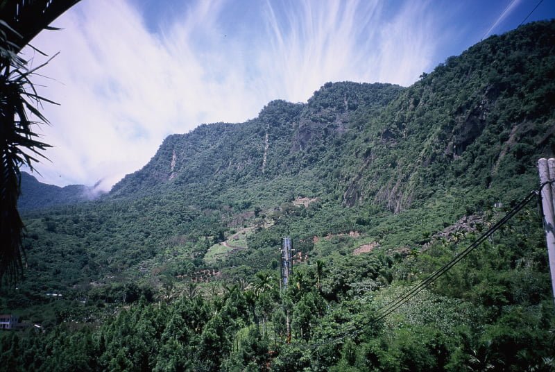
The Republic of China features a unique power grid coordinate system. If you ever encounter a mountain emergency or find yourself lost on unfamiliar roads, you can call for help and report this code to determine your exact location (Coordinate Conversion Tool).
Experience has shown that many outdoor hikers and stranded travelers have received prompt and effective rescue from local fire and rescue services thanks to their understanding of this coordinate system.
The Taiwan Power Company (Taipower), established in the Republic of China, marks every utility pole and electrical distribution box with a sequential alphanumeric identifier formatted as “A0000AA00”. This is known as the Taipower Grid Coordinate System.
The numbering spans from A0000AA00 to Z9999HE99, covering Taiwan proper as well as Green Island, Orchid Island, Penghu, Kinmen, and Matsu archipelagos.
Naturally, the theoretical base coordinate A0000AA00 sits out in the open ocean, so you will never encounter that specific physical plaque.
If you are curious about the authenticity of this grid system, simply look up at any nearby utility pole during the day. You will see this sequence stamped onto a metal plate, and you can convert that code using a mapping program to pinpoint your precise real-world position.
Taipower Grid Coordinate Format Explained
The first English letter (A) divides Taiwan and the outlying islands (Penghu, Kinmen, Matsu, Green Island, and Orchid Island) into primary rectangular zones lettered A through Z. Each primary zone spans 80 kilometers wide by 50 kilometers high.
The second group contains 4 digits (0000), which uses an X-Y coordinate grid to divide each primary zone into 10,000 secondary blocks, numbered individually. Each secondary block measures 800 meters by 500 meters.
The third group consists of two letters (AA). Using A through H east-west and A through E north-south, this divides each secondary block into 40 tertiary blocks, each measuring 100 meters on a side (10,000 square meters).
The final group consists of two digits (00), which subdivides the tertiary block into 100 quaternary sub-blocks, each measuring roughly 10 meters on a side.
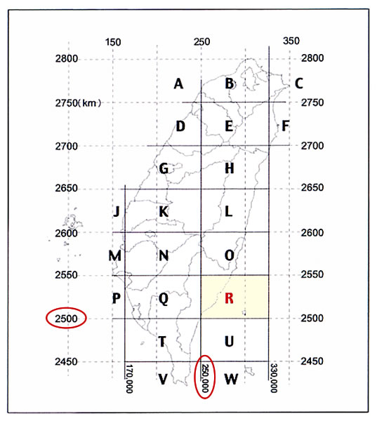
Taipower Outdoor Grid Coordinate Map
Results and Discussion
Barring physical construction errors or significant geological shifts, the positional accuracy of Taipower’s grid coordinates easily reaches single-digit meter precision.
In the era before ubiquitous smartphone navigation, when handheld GPS receivers suffered from poor satellite reception in deep valleys, mastering this power coordinate system was essential knowledge for every mountaineer! If GPS signals drifted, search and rescue teams could easily search an entire ridge away from you.
Furthermore, hikers with strong spatial awareness can even compare sequential pole coordinates along a trail to verify whether they are walking in the correct geographical direction.
Further Reading
- Deciphering the Power Grid Coordinate System and Typhoon Rescue Records (Sun River Culture Co., Ltd.)
Support Independent Perspectives & In-Depth Insights
Every thoughtful analysis and candid critique comes from our dedication to truth and quality. We choose not to follow sensational algorithms or clickbait headlines.
Sustaining independent research requires reader support. Make a one-time or monthly contribution, securely processed by Google.
Payments secured by Google · Manage or cancel anytime in your Google Account




Comments