
From April to June each year, as lowland temperatures gradually warm up with the arrival of spring, the “Tateyama Kurobe Alpine Route”—nestled as a core scenic highland corridor between Tokyo, Osaka, and Nagoya—becomes an absolute bucket-list destination for countless travelers. The weather here is crisp and refreshing; in early summer, visitors can still wander directly among towering perennial snow walls and vast alpine snowfields.
A Japanese friend whom I have known for years recently posted photos on social media of her stylish snowboarding trip to Tateyama Kurobe (having just taken second place in a snowboard competition), sparking deep wanderlust.
Yet on travel forums and social platforms, travelers frequently post anxious queries: “I have already reached Japan and arrived in downtown Toyama, but the weather forecast for Tateyama Kurobe looks grim with heavy rain predicted. If I head up the mountain, will it just be thick fog with zero visibility?”
Conquering the Tateyama Kurobe route without regret comes down to understanding the unique “climatic physics” of high-altitude mountain environments and leveraging accurate live conditions.
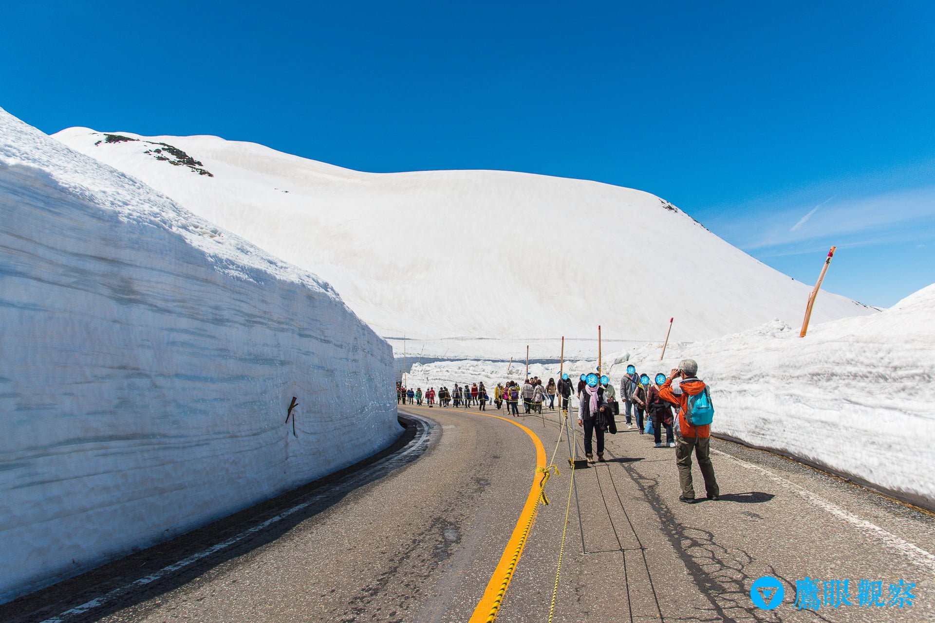
Stepping into Tateyama Kurobe: The Route’s Massive Vertical Span
The “Tateyama Kurobe Alpine Route” (Japanese: 立山黒部アルペンルート) is a world-renowned mountain sightseeing corridor connecting “Tateyama Station” in Tateyama Town, Nakaniikawa District, Toyama Prefecture, with “Ogizawa Station” in Omachi City, Nagano Prefecture. The entire route was officially inaugurated on June 1, 1971.
The route originally began as a grueling infrastructure project to transport massive construction materials and machinery for the Kurobe No. 4 Power Station (Kurobe Dam). Following the dam’s completion, the corridor was transformed and opened for general public tourism. The entire traverse lies squarely within Japan’s core “Chubu-Sangaku National Park” and operates only from mid-April through mid-November, closing during the harsh winter months due to catastrophic snowfall.
A crucial meteorological factor to understand is: the route’s maximum vertical elevation difference reaches an astounding 1,975 meters!
The transit network employs multiple eco-friendly specialized transportation modes, including funicular cable cars, highland electric buses, trolleybuses, and aerial ropeways. Ascending from lowland elevations of a few hundred meters all the way to “Murodo” at 2,450 meters creates dramatic microclimates across vertical zones.
Why Is It Clear in the Lowlands but Stormy on the Mountain?
First-time visitors often make the critical mistake of relying exclusively on weather forecasts for downtown Toyama or Nagano City:
- Dramatic Temperature Drops with Elevation: Under atmospheric physics, air temperature drops approximately 6°C for every 1,000 meters of elevation gained. When downtown Toyama sits at a comfortable 20°C, Murodo Station at nearly 2,500 meters often hovers near 5°C or dips below freezing!
- Orographic Precipitation and Windward Slope Effects: Moisture-laden air masses blowing from the Sea of Japan are forced upward when striking the steep barrier of the Tateyama Mountain Range and Hida Mountains. This moisture rapidly condenses into dense cloud cover and precipitation. Consequently, while the plains bask in blue skies, ridgelines and mountain shoulders may be enveloped in dense fog or sudden convective showers.
- Severe Mountain Gusts and Transit Suspension Risks: Convective wind gusts along alpine ridges are formidable. When wind speeds become excessive or visibility drops critically, the “Tateyama Ropeway” (operating between Daikanbo and Kurobedaira) or highland buses may preemptively reduce service frequency or temporarily suspend operations for passenger safety.

Tateyama Kurobe Seasonal Climate and Clothing Recommendations
| Months | Average Temperature Range (Murodo) | Weather & Environmental Characteristics | Recommended Gear & Layering Strategy |
|---|---|---|---|
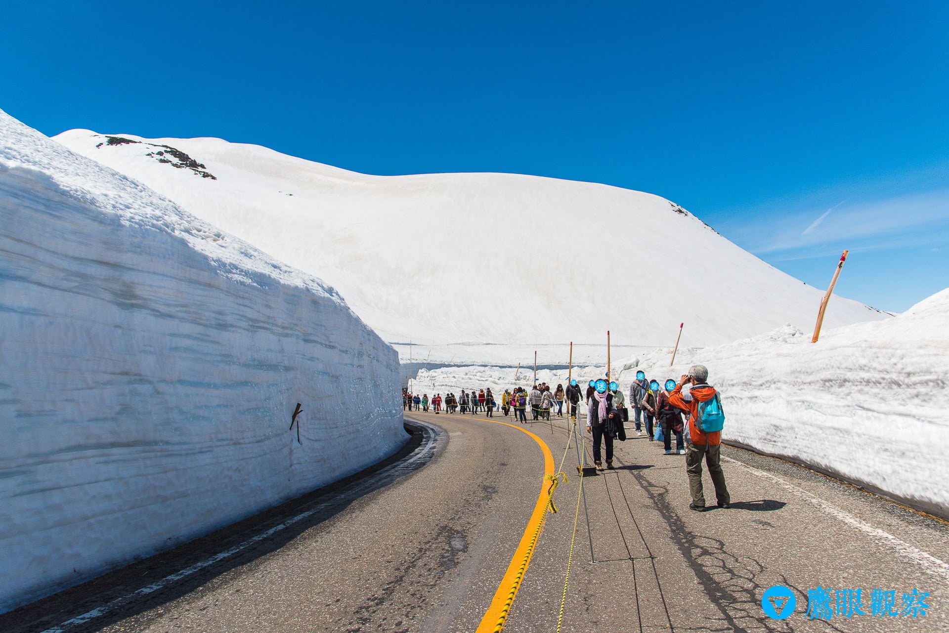
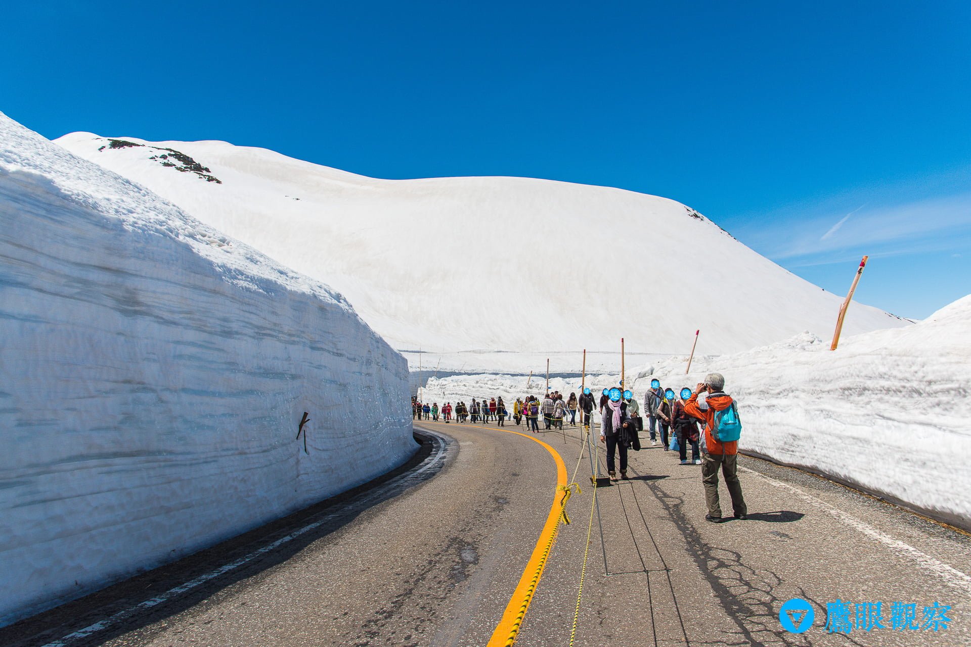
| April – May (Spring Opening) | -3°C – 10°C | The Yuki-no-Otani snow walls reach peak heights (15–20 meters); thick snow covers the ground; intense UV glare | Onion Layering: Windproof/waterproof shell (GORE-TEX), thermal base layer, lightweight down jacket, polarized sunglasses (prevent snow blindness), slip-resistant waterproof boots |
| June (Early Summer Thaw) | 7°C – 15°C | Gradually warmer weather; snow walls melt and recede; fresh greenery sprouts; higher rainfall during the rainy season | Rain-Ready & Lightweight: Breathable windbreaker, light long-sleeve layers, waterproof hiking shoes, compact travel umbrella |
| July – August (Summer Retreat) | 12°C – 22°C | The coolest summer escape; dramatic water discharge spectacles at Kurobe Dam; alpine flora in full bloom | Moisture-Wicking: Light jacket (significant day-night temperature swings), breathable quick-dry t-shirts, sun hat, UV sunscreen |
| September – October (Autumn Foliage) | 3°C – 15°C | Vibrant autumn foliage sweeps down from mountain peaks to valleys; temperatures fall rapidly; first autumn flurries | Thermal Protection: Windproof jacket, warm fleece/sweater or down vest, insulated gloves, beanie |
| November (Pre-Closure Countdown) | -5°C – 5°C | Deep winter approaches; frequent snowfall; temperatures plunge well below freezing; preparations for winter mountain closure | Full Winter Insulation: Heavy insulated winter down parka, snow grip winter boots, windproof beanie, scarf, insulated winter gloves |
3 Essential Live Weather Tracking Tools Before You Depart
If the forecast for your departure date looks doubtful, do not panic. Make smart use of these 3 official and specialized monitoring tools:
- Tateyama Kurobe Official Live Cameras: The official portal maintains 24-hour high-definition live camera streams at Murodo, Daikanbo, Kurobedaira, and Kurobe Dam. Checking mountain-top visibility during breakfast on the morning of your trip is the most straightforward way to judge real-time conditions.
- Japan Weather Association (tenki.jp) Mountain Weather Section: When searching for weather forecasts, do not simply search for “Toyama Prefecture.” Instead, specifically check the alpine portal for “Tateyama (Oyama / Murodo)”. This provides specific wind force scales, precipitation probabilities, and climbing suitability indices (Grades A/B/C) at altitudes above 2,000 meters.
- Official Operational Status and Live Transit Alerts: The homepage of the Tateyama Kurobe official website updates daily around 06:00, broadcasting real-time operational status or weather delays across each transit mode (highland buses, aerial ropeways, tunnel electric buses), serving as the single most authoritative source for itinerary adjustments.
Conclusion: Embrace the Many Faces of the Alps with Respect and Preparation
The majesty of nature goes hand-in-hand with its unpredictability. On clear days, Tateyama Kurobe resembles an enchanting ice palace surrounded by pristine white snow; when cloaked in rolling clouds and mist, it transforms into a mythical ink wash wonderland.
As long as you prepare adequate windproof and warm onion-style layers, pack slip-resistant waterproof footwear and UV sunglasses, and stay informed via real-time official transit alerts, you can remain completely at ease—ready to take in breathtaking panoramas the very instant the mountain clouds part!
Support Independent Perspectives & In-Depth Insights
Every thoughtful analysis and candid critique comes from our dedication to truth and quality. We choose not to follow sensational algorithms or clickbait headlines.
Sustaining independent research requires reader support. Make a one-time or monthly contribution, securely processed by Google.
Payments secured by Google · Manage or cancel anytime in your Google Account

Comments